| Maps:
|
Sheet 350: Edinburgh, Musselburgh & Queensferry.
|
View Blackness to North Queensferry in a larger map
|
| Start: |
NT050799. The Square, Blackness.
|
|
Route:
| Click here to view the route superimposed on GoogleEarth
(GoogleEarth must be installed on your computer
in order to view - click here to download GoogleEarth).
The idea for this walk came from Country Walking magazine - but their walk was a circular, starting and ending at Blackness.
With a bus service only once every 2 hours, we decided that we'd turn it into a linear route, finishing somewhere with more
frequent public transport. We took the frequent train service from Edinburgh to Linlithgow, then the bus to Blackness.
We returned to Edinburgh by the frequent train service from North Queensferry.
The route follows clear paths, tracks and roads, passing an impressive castle, a stately home, through woodland, parkland
and finally crosses the Forth Road Bridge, with impressive views of the estuary and the rail bridge. The bridge is closed
on days when there are high winds, so the walk would have to end at Dalmeny railway station.
|
|
More info:
|
Blackness Castle - from Historic Scotland;
Hopetoum House - property website;
Forth Road Bridge - Forth Estuary Transport Authority;
Forth Railway Bridge - Network Rail archive;
Forth Replacement Crossing - Transport Scotland.
|
|
Refreshments: |
Ice cream, sweets, etc, from Blackness Castle;
Tearoom at Hopetoun House (when open- see link above for opening times));
Pubs and cafes in South and North Queensferry.
|
|
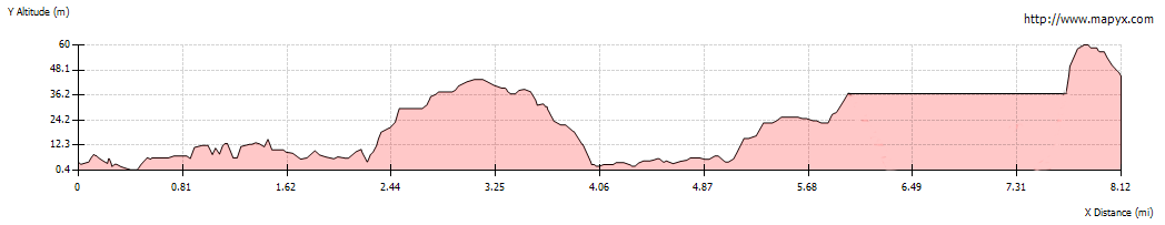
| Route profile: |
|

|
From the bus stop outside the Blackness Inn, follow the road by the shore towards Blackness Castle
(well worth stopping off to explore).
Immediately in front of the castle gates go through the kissing gate on the right. The path follows
the castle wall and then descends to a grassy path above the beach.
|
|

|
Walk along the grassy path - on a clear day you should have a first view of the bridges - unfortunately
the mist prevented us from seeing more than a very faint outline of them!
|

|
The path bears to the right to follow Black Burn. Where the path meets cycle track (no 76) turn left
and cross the bridge pictured above.
|

|
After crossing the bridge pass through gate into Wester Shore Wood.
|

|
The clear path continues through the woods for about 1˝ miles.
|

|
At a junction of tracks, turn left to follow the cycle track waymark.
|

|
The path runs between a stone wall on the left and Corrie Burn on the right.

|
Continue ahead at next junction (following sign for Hopetoun House and South Queensferry).
Pass through a high kissing gate and continue to follow the track …
|

|
… with the stream still on your right.
|

|
At a T junction, turn left to follow the road.
|

|
As you walk along the road look to the left to see Hopetoun House through a gap in the trees.
|

|
Turn left again at the next road junction and Follow Deer Park Road until you pass a white cottage on the left.
The road turns to the left, but our route continues ahead following the …
|

|
… grassy track. The track leads through tall gates to …
|

|
… continue ahead along a surfaced road.
At the next junction turn left (again following the cycle track marker post) then …
|

|
… at the next turn right (unless the house is open and you wish to visit - the public drive to the house is
left at this junction). As it was winter, the house wasn't open on the day of our walk).
|

|
We turned left down the private road towards Society House (though continuing straight ahead would have cut off a corner).
|

|
The road brings you back to the estuary and swings round to the right to follow the river bank.
|

|
There are views of the rail and road bridges, along with the construction site for the replacement crossing.
Continue walking east along Society Road.
|

|
After passing the construction site entrance the road leads through a residential area. In this area it becomes
Hopetoun Road.
This road emerges at a junction with the B924, almost immediately underneath the Forth Road Bridge. Cross the main B924 and follow the footpath under the bridge.
|

|
Where the path meets a service road, you are directed to whichever footway is open - it was the eastern footway on the day of our walk.
|

|
The crossing is about 1˝ miles in length - this was the longest span in Europe when it was opened in 1964.
|

|
This footway gives splendid views of the rail bridge and North Queensferry - the western footway is likely to become
increasingly interesting as construction on the new bridge progresses.
|

|
At the northern end of the bridge there are steps on the right. The steps going down lead to North Queensfserry itself.
We took the steps leading up, for the shortest route to the station.
|

|
The steps lead to a path which emerges at the end of Brock Street, between a playground and a community centre building.
Follow Brock Street as it winds first to the right and then to the left. You will soon see the black and white building of the
railway station on the left.
|

|
We entered the station and crossed the footbridge to wait for one of the frequent trains back to Edinburgh. The photograph above is taken from the Edinburgh bound platform, looking south to the railway bridge.
|


