This walk is available to download as an e book in Kindle format from Amazon or in
epub format from Kobo
- take the route description
with you on your mobile device.
| Maps: | Sheet OL1 Peak District - Dark Peak area . |
View Castleton in a larger map |
| Start: | SK149830. Pay and display car park, Castleton. | |
| Route: | Click here to view the route superimposed on GoogleEarth
(GoogleEarth must be installed on your computer
in order to view - click here to download GoogleEarth).
Mam Tor stands on the boundary of the limestone scenery of the White Peak and the gritstone moorland of the Dark Peak. It provides stunning views in all directions, and so is a very popular. This walk starts from one of the Peak District's honeypots, and leads up a typical limestone gorge onto the limestone plateau. A further short, steep climb leads to the summit of Mam Tor. The return to Castleton is via a paved ridge walk, followed by a steep descent. All paths and tracks are well-used and easy to follow. | |
| More info: |
Cavedale (Wikipedia); Mam Tor (Wikipedia); Mam Tor(British Geological Survey); Castleton.co.uk; Castleton Visitor Centre (Peak District National Park Authority). |
|
| Refreshments: | There is plenty of choice in Castleton. Lin enjoyed the homemade soup at the Causeway Shop whilst I enjoyed a cream tea, with warm, scones, jam and clotted cream. | |
| Route profile: | 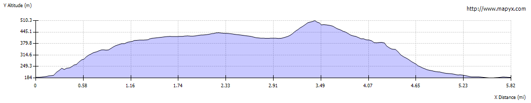
|
|

|
Leave the car park and turn left along the road towards the village centre. Turn right into � |
|

|
� Castle Street. Follow the road round to the left, passing through Market Place. Bear right into � | |

|
� Bargate. Look out for the small brown finger post on the left, pointing towards Cavedale. Turn right to follow the track between cottages. The path climbs gradually through a steep-sided limestone gorge � | |

|
� before opening out a little. Continue to follow the dry valley � | |

|
� not forgetting to turn round to admire the view of Peveril Castle, perched above the dale on its western side. | |

|
The path becomes less steep � | |

|
� and opens out onto a limestone plateau. | |

|
Continue to follow the main path as it passes through a couple of narrow gates � | |

|
� leading to the corner of a field with a wide gateway and stile. Pass through the gate (or climb the stile) � | |

|
� almost immediately there is another gate and stile. These lead onto a gravel track. | |

|
Turn right to follow this track for about 200 metres. | |

|
Turn right where a gate crosses the track ahead. Follow this straight track for almost a mile (about half way along the surface changes to tarmac). | |

|
This track emerges onto the unclassified road above Winnats Pass. Cross the road and pass through the gate almost opposite. | |

|
Follow the path to a gate which leads onto another unclassified road. Cross this and follow the clear path opposite to pass through a gate and up steps � | |

|
� to meet another unclassified road. Don't cross this road, but walk a few yards along a paved path to go through a narrow gate on the right. | |

|
The path from here up to the summit of Mam Tor is very heavily used (due to the nearby National Trust car park). Follow the well surfaced path to the top of the hill. | |

|
Mam Tor provides spectacular view over the limestone plateau to the south � | |

|
� and the gritstone moorland to the north and west. | |

|
From the summit follow the very popular, paved path leading north east along the Great Ridge between the Hope Valley and Edale ... | |

|
� to Hollins Cross. This is a dip in the ridge where a number of paths meet. There is also a memorial pillar to Tom Hyett. Go through the gate (which has been moved a few metres along the ridge to help control erosion). Once through the gate � | |

|
� take the path which curves to the left. | |

|
Follow the path down the hillside. | |

|
In places this path is very steep and uneven. It also crosses a couple of stiles, one of which was broken and difficult to climb on the day we completed the walk. | |

|
At the foot of the descent pass through a wooden gate ... | |

|
� to follow a narrow, sunken path. | |

|
Another gate leads onto � | |

|
� a narrow, surfaced road (Hollowford Road). | |

|
The road takes you back to Castleton. Join the main road through the village � | |

|
� which turns to the right and leads back to the car park, just beyond the village centre on the right. |
Other walks near here:
Every care has been taking when preparing this route description, but the author cannot be held liable for any
omissions or inaccuracies - or any changes made to footpaths since these notes were written.
We always welcome feedback
(email graham@gandljdean.co.uk).
All text and images ©Graham Dean, December 2013.
Back to:


