|
Walk south along Main Street, then bear left on to Dock Road. Continue to walk along the
road, passing the lifeboat station. At crossroads turn left and continue to the end of the road. Walk through
car park and follow footpath alongside the beach.
|
|

|
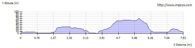
Continue along the promenade at Spittal. After the last houses and just before the end of the promenade turn right to follow a narrow tarmac path up
to the top of the cliffs. Turn left at the top to follow the clifftop path for just over a mile. Where the path meets
the road, turn right to follow the road.
|

|
We dropped down to the beach using the first steps we came to, then
walked along the beach until we came to a stream which was too deep and fast flowing to cross (in summer we
might have paddled). We re-traced our steps along the beach, then the road. Instead of returning by the clifftop path,
we continued to follow the road over the level crossing to the road junction at Borewell. Here we
turned right and stopped at the cafe at Pot-a Doodle Do for tea and scones. Continue along the road for just under
half a mile, until the road turns sharp left. Here we followed the footpath ahead, signed for Cow Road.
After just less than another half mile, go through a wooden kissing gate and turn right to follow permissive path
to Seaview Farm.
|

|
The path leads round Seaview Farm. Follow the track towards the clifftops, which leads under the railway
down to Main Street in Spittal. We followed the road to the far end of Spittal, went straight across
at the crossroads to re-joining the outward route.
|

|
Shortly after passing the lifeboat station take the path on the left which goes under the disused
railway viaduct. Climb the steps on the left, then turn right, around the terraced houses. Turn left to follow
the disused railway line. Where the path emerges onto Mount Road, turn left, then at the junction with Main Street
turn right to return to the start.
|