| Map: | Sheet 242 Telford, Ironbridge and the Wrekin |
| Start: | Car park north east of the Wrekin (SJ637092) |
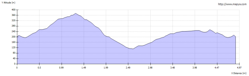
| Route: | This circular walk leads over the summit of the Wrekin, with its extensive views in all directions. The route continues along the ridge, over Little Hill, then descends to the road. The return route is through woodland to the south east of the ridge. The walk is on clear paths and tracks, mainly through woodland, some of the descents are steep. |
| More info: | from Wikipedia from Wellington Arts and Heritage Alive |
| Refreshments: | At the Halfway House on the track up the hill. |
|
|
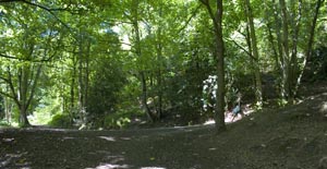
From the car park entrance, cross the road, and take the track next to disused public toilets. The main track zig-zags up the hill. Avoid steep paths to the right, unless you want to make the walk more demanding than it need be. Do turn sharp right at the junction pictured |
|
|
|
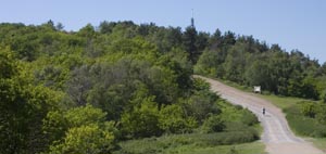
Just before the next sharp bend, the Halfway House, on your right serves refreshments. Pass by the double gates and turn left. As the track continues uphill, the path becomes more open. | |
|
|
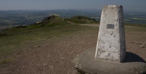
The highest point of the hill is marked by the trig point shown. There are splendid views in all directions, with a plaque shows the most important points of interest. | |
|
|
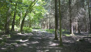
The path continues along the ridge, descending quite steeply in places and re-enters the woodland. After about half a mile there is a crossing of paths. To shorten the route (and avoid climbing further) turn left. To complete the full route continue ahead and up Little Hill. It's all downhill to the road. Beyond the wooden gate turn left along the narrow road. | |
|
|
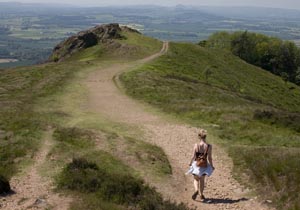
Walk along the road for about 160 metres, then take a footpath on the left. This path climbs gently for about 1½ miles. There is always woodland to the left, but there are stretches where there are open fields on the right. The path starts to descend gently, followed by another short, gentle ascent. After this, it's all downhill to the junction of paths at SJ636088 (first photograph). Take the right fork, which retraces the original route down to the car park. |
Other walks near here:
Back to:


