| Maps:
|
Sheet 296 Lancaster, Morecambe and Fleetwood (a very, very short length of the walk is on Sheet OL7).
|

|
| Start and Finish: |
SD468665 - Hest Bank Beach Car Park. |
|
Route:
|
A fairly level route which follows the Lancaster Canal towpath, followed by a short stretch along quiet roads,
before crossing open fields and finally returning to the start along the edge of the beach.
|
|
Links to route files: | .gpx (for many handheld devices)
.kml (Google Earth - Google Earth must be installed on the device in order to open this file)
|
|
More info:
|
|
|
Refreshments: |
I don't think that we've ever completed a rural walk with as much choice: 2 cafes, a chip shop and a pub at
Hest Bank; another chip shop and 2 pubs at Bolton-le-Sands (we had an enjoyable lunch at
the Royal). In summer there are also
refreshments available from the caravan sites close to the route.
|
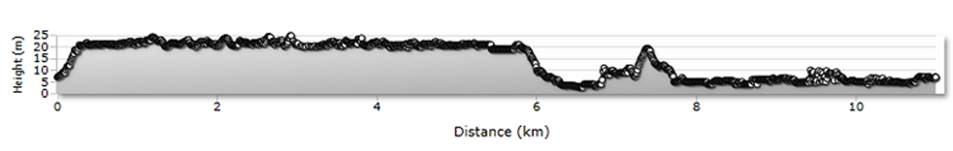
| Route profile: |
|
|

|
If you have parked on the beach car park, then cross the railway (West Coast Mainline) by the level crossing or the footbridge,
then also cross the main road.
|

|
Walk up the road directly opposite the level crossing (Station Road).
|

|
At the top of the road cross the Crescent and climb the steps to the canal towpath. Turn left.
|

|
After only a few yards you pass under this bridge - if you wish to visit the first pub,
the Hest Bank Inn, leave the canal and cross the bridge
(we didn't stop here this time, but have enjoyed liquid refreshment in the beer garden previously).
|

|
Continue past the packet boat landing stage at Bolton-le-Sands (unless you wish to shorten the walk - in which case leave the towpath by the Bridge pictured. Follow the road downhill, passing the chip shop on your left. Turn right along the village bypass. Cross the road opposite the Royal and turn
left to follow Mill Lane to the coast. Turn left and walk along the coast to return to Hest Bank).
|

|
The next packet boat landing stage is outside the Royal (the gate on the left leads from the towpath to the beer garden - the steepest part of our walk was climbing the steps between towpath and bar).
Continue along the towpath for just over a mile then ģ
|

|
ģ look out for the cycle route sign. Follow this down steps to the road.
If you wish to lengthen the walk, then continue to Carnforth
(with even more options for refreshments, including the Canal Turn which is right by the towpath).
Return along the towpath to this point to continue the walk.
|

|
Turn left then cross the road at the pedestrian refuge. Follow the cycle route sign
along Longfield Drive (in the direction of Warton and Silverdale).
|

|
Bear right to follow Crag Bank Road crossing this railway bridge: this is the view to the north,
showing the edge of the Carnforth MPD site.
|

|
Where the road bends to the right (just before Crag Bank playground) follow the footpath sign on the left
and climb the stile by the gate pictured.
|

|
Where they surfaced path turns to the right, keep straight following an indistinct path which continues ahead leading ģ
|

|
ģ to cross another stile (almost hidden by the long grass).
|

|
Cross the field to another stile.
|

|
In this field follow the fence and dike on your right, leading to yet another stile. In the final field continue to follow the fence to start with, but when you are opposite a dike leading off at right angles,
head across the field up a slope to the field boundary on the left.
|

|
Go through the stile by the gate at the top of the slope and then walk along this enclosed grassy/muddy track.
|

|
A stile at the end of the track leads to a caravan site access road. Turn right to follow the road through the site.
|

|
At most of the junctions through the site the main route is clear and signposted.
At the one junction the route isn't clear bear left.
|

| Go through the gate shown in the centre of the photograph and turn left ģ
|

|
ģ to follow the path along the edge of the shore.
|

|
Where the path meets the road pictured, continue in the same direction.
|

|
Turn right at the road junction and follow the road for a short distance, passing Mill Lane Car Park ģ
|

|
ģ until the road bears left. Follow the stony path ahead.
|

|
Continue along the path which skirts the marshy coastline ģ
|

|
ģ and then climb steps to walk along the top of the flood defence.
|

|
Near Red Bank Farm an information sign explains the journey of eels and how it is hoped the tidal flap will help with their conservation.
The OS map shows the right of way passing through the caravan site, but we continued to walk along the edge of the beach ģ
|

|
ģ which became quite a rocky route!
|

|
Continue along the beach ...
|

|
ģ until you are back at the car park at Hest Bank.
|
All text and images ©Graham Dean, February 2015.


