Map: Sheet 287 West Pennine Moors
Start: Sunnyhurst Car Park, Darwen (grid ref. SD679224). Alternatively the walk could be started at Belmont (SD674158). Refreshments: Sunnyhusrt Hotel and the Lychgate Restaurant near the start, the Black Dog at Belmont and the Royal Arms near Tockholes.
This walk is described in a little more detail than most of the others because it is not based on a route from a book.
A short length of the walk is along a road - most of it is on well-defined bridle paths or tracks.
From the car park entrance, turn right along the track. Where the path forks just beyond cattle grid and an isolated house (built by Darwen Corporation Waterworks - notice the datestone over the door)take the left fork. Take left fork at next junction and continue along the track past Higher Wenshead Farm.
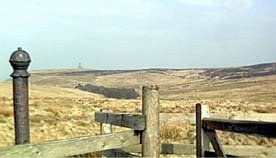
Where the track bends very sharply to the right, go through the 2nd gateway on left, the reservoir feeder stream on your left hand side. The path climbs steadily uphill, to open moorland. Where the path bends to the left, take a path to the right. This continues to climb for a short distance. Go through a gate and pause to admire views ahead to the coast and behind over Darwen Moor to Darwen Tower, Pendle and the Yorkshire Dales. The path descends , zig-zagging down to the road.
Turn left and follow the road for just over half a mile. Where the road bends to the right - follow the bridlepath straight ahead. The path skirts the moor, soon providing views over Belmont Reservoir. Take the path on the right, past Higher Pasture House and through the farmyard of Lower Pasture. Follow the path to the reservoir and cross the road along the dam. At the far side, take the path on left to main road. Turn left along road into village. We walked to the Black Dog, which is at the corner of Rivington Road.
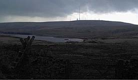
There are higher level alternative routes back - but we chose to return via a less demanding route - especially as the weather had deteriorated (as can be seen from the second photograph)
Retrace path until you reach a point where a bridlepath leaves the minor road (grid ref. 665197). Follow this path down to the ruins of Hollinshead Hall. Keep straight ahead at junction of paths. Walk down through the woodland until there is a junction of paths near a bridge. Take the path up steps on the right, and follow finger posts pointing to Information Centre.
The path emerges from the woods opposite a car park and bus turning circle. Turn left along road, then right at the Royal Arms. After passing a row of cottages (one with a large conservatory) go through the narrow gate on right, and follow field path downhill. Cross reservoir feeder stream and then walk uphill to cross stile. Just beyond ruined farm (only one low wall and three windows remaining) go over stile and re-join track to Sunnyhurst.
Back to:
Walks Index
Graham Dean's Home Page