Above Dent (approx. 6.5 miles)
Map: Sheet 2 Yorkshire Dales - Southern and Western
areas
Start: Dent car park(SD704872)
This route starts by following the River Dee out of the village, then ascends to the
Occupation Road, before descending quite steeply down Flinter Gill back to Dent. Before starting out, we had enjoyed a substantial breakfast at the Sportsman's Inn, where we had stayed the night.
Dent - Dillcar (approx. 2.75 miles)
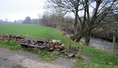
Leave the car park and turn right, following the road away from the village. After about 500 yards the Dales Way footpath joins from the right. Take the next stile on the right to follow the river bank (and the Dales Way), walking north west. 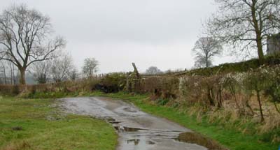 Cross the road at Barth Bridge, and continue straight across, following the footpath. The path takes you through numerous gates, and over a number of bridges, before emerging on an unclassified road.
Turn left and then climb the ladder stile on the right, following the sign, "Dillcar 200m". Go up the hill and through the farmyard, keeping left between a stone outbuilding and one clad in corrugated steel.
Cross the road at Barth Bridge, and continue straight across, following the footpath. The path takes you through numerous gates, and over a number of bridges, before emerging on an unclassified road.
Turn left and then climb the ladder stile on the right, following the sign, "Dillcar 200m". Go up the hill and through the farmyard, keeping left between a stone outbuilding and one clad in corrugated steel.
Dillcar - Barbondale Road (approx. 1.5 miles)
Follow the farm track down meet the unclassified road, turn right. Only a few yards along the road there is a footpath sign to Bowker Bank and Stone Rigg. Follow the sign along a track, then turn sharp left away from the track, through a gate. The path climbs diagonally across a field, passing the ruined Raw Banks. 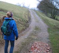 Take care to head to the top corner of the field, where there is a gate. Go through the gate and turn right on to the track pictured here. At Tofts, go ahead through a gate and follow the yellow arrow painted on the side of the barn, ahead to pass through a further gate.
The path descends to a stream, crossed by a narrow bridge. Climb the wooded bank, and cross open fields to the ruined Combe House. 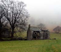 When we completed this walk in April 2004 there were planning
notices attached to this listed building - it may soon be restored to its former glory - though this may mean that the path from here to the Barbondale Road will also be upgraded to tarmac!
When we completed this walk in April 2004 there were planning
notices attached to this listed building - it may soon be restored to its former glory - though this may mean that the path from here to the Barbondale Road will also be upgraded to tarmac!
From Combe House, the clear path passes a barn, and the climb becomes more gentle, soon to level out, before sloping down to a wet area. I can't remember if it was a stile or a gate (or even just a gap in the wall) that lead to an area of shakeholes, through which the path lead up to the road.
Barbondale Road - Dent (approx 2.25 miles)
Turn right and follow the road to the bridleway on the left. Follow this track
(Occupation Road, built in the 18th century at the time when the open land was enclosed). This track showed signs of being used by off-road vehicles - though there were none on the day we completed the walk. We were unfortunate that we were unable to admire the views of Dentdale, as we were walking above the cloud level! After just over a mile, there is a sign on the left for Dent.
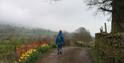
Follow the very steep, stony track downhill back to Dent.
Back to:
Walks Index
Graham Dean's Home Page