| Map: | Sheet OL24 Peak District - White Peak area |
| Start: | Sir William Hotel, Gridleford (SK242778) |
| Route: | This circular walk starts from the Sir William Hotel (where we were staying), but could be lengthened slightly to start from Grindleford Station or the Maynard Arms (where we have stayed in the past). Because we walked after a period of very heavy rain, there is more of the route along (very quiet) roads than usual for us. Other sections of the walk are along field paths and clear tracks. Points of interest include the "Roman Baths" at Stoney Middleton, and the whole of the "plague village" of Eyam. |
| More info: | More about Eyam Wikipedia, from from www.cressbrook.co.uk and from www.derbyshire-peakdistrict.co.uk (the latter two sites also have information about Gridleford and Stoney Middleton). |
| Refreshments: | Plenty of choice in Eyam (except on Mondays) and pubs in both Stoney Middleton and Grindleford. |
|
|
|
As we were staying at the Sir William, we parked on the hotel car park, but there were other
walkers cars parked on Sir William Hill Road. Walk a few yards up Sir William Hill Road from its junction
with the B6001, passing the methodist chapel. Follow the footpath finger post on the left, with cottages on your right.
Enter field and walk across to trees in top right corner. Cross a stile into another field and
turn left, following field boundary. After about 150 yards the path crosses to field on left and then continues in the
same direction.
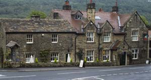
The route continues downhill close to the field boundary on right. Leave the field by crossing stile on right and continue downhill to cross Goatscliff Brook. Walk uphill towards farm buildings and fingerpost at top left of field. Cross a stile onto farm road and follow this to its junction with New Road (B6521). Turn right and follow this road for about three quarters of a mile. Where the road takes a right and there is a footpath on left, continue along the track ahead. This descends, fairly steeply in places, between trees to emerge in Stoney Middleton. |
|
There is a graveyard on your left, then at a sharp right hand bend the
surface becomes tarmac. Pass cottages on the right and then the so called Roman Baths.
Follow the road round bends, past church to T junction. Turn right to continue the walk, or left
to the busy main road (A623) for refreshments at the Moon Inn.
Follow the minor road through the village, then just before it joins the main road turn right and then straight on, following a sign on the wall for Eyam. this leads along Cliff Bottom and then Mill Lane. Just beyond a blue sign announcing that the road is unsuitable for vehicles there is wooden stile on the left. Cross the stile, following the finger post pointing towards Eyam. This leads up a steep grassy bank. The path passes quite close to the summit (on your left). Look out for the Boundary Stone, where food was left for the villagers of Eyam during the plague. Continue along the path to a stone stile, which leads to a path enclosed by stone walls. Squeeze through a narrow stile stile to pass through the middle of a field. Pass through gate posts and by the side of two aluminium gates. The track emerges between gateposts on to tarmac road. Continue ahead, passing the Lydgate graves (where a family of plague victims were buried) on left. |
|
On most days of the week there
is a variety of establishments in Eyam offering refreshment - but on Mondays most are closed (we had
a drink at the Miner's Arms).
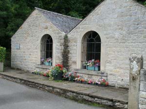
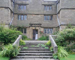
Bear left to walk through the village along Church Street. There are information plaques by many of the buildings, providing details of their history. The market hall (on left) has information about the village history. Pass Eyam Hall and craft centre on the right. Turn right up Hawkhill Road (signposted to the museum). Pass between Eyam Museum on left and a car park on right. The museum is well worth a visit. Continue walking along the road, which bends to the right, then passes a Youth Hostel on the left. Further up on the left pass a road junction and Mompesson's Well (not really a well, as the information board explains). The road levels, and bends to the right, becomes Sir William Hill Road and leads back to the start. |
Back to:
Walks Index
Graham & Lin Dean's Home Page