Map: Sheet OL24 Peak District - White Peak area
Waterhouses lies midway between Leek and Ashbourne on the A523. There is a car park, picnic site and cyle hire signposted from the main road. We didn't use the public car park, as we were staying in a self-catering cottage at Brown End Farm when we completed this walk (making it a few hundred yards shorter for us, than for those who start at the car park)!
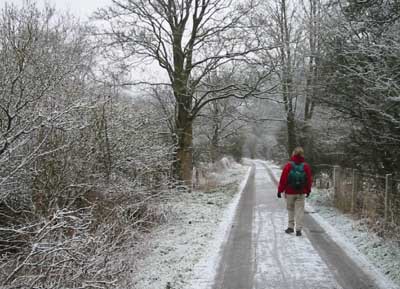
Follow the Manifold Trail as it winds its way through woodland, by the side of the River Hamps. The trail, a former railway track, has a smooth tarmac surface - keep you eyes open for cycles! The path crosses and re-crosses the river a number of times, until you reach its confluence with the Manifold below the impressive limestone cliffs of Beeston Tor.
From here the river remains on your right, as does a farm road, until you reach a minor road. Cross the road and continue on the trail, keeping the river on your right. The next bridge is only for foot traffic heading for Wetton, or investigating Thor's Cave.
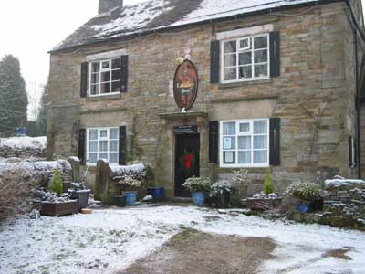
Climb the stile on your left up to the National Trust's Ladyside Wood. After zig-zagging up the hillside, through woodland. The path levels out and skirts the contours. On leaving the woods, despite following clear signposts and waymarkers, we didn't enter Grindon along the path we had intended! Instead we met the road between the village and Ladysides at a junction of paths. We followed the road to the left, past the church and picnic area. We turned right at the road junction intending to seek refreshment at the Greyhound pub. Alas it was closed!
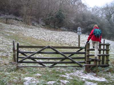
From the pub, follow the road signs for Manifold Valley until you come to the former school on the left. Just beyond the school, at a finger post on the right, leave the road and follow a track. The public right of way is actually shown to the left of the track. Being law-abiding, we used the path, climbing a series of rickety stiles, until the right of way re-joined the track. If we were to complete this walk again, we would use the track all the way! The walled track ends at a metal gate. At the other side of the gate a path leads along the right of a fields. After walking downhill, at the far side of another metal gate, a (slightly mis-aligned) finger post indicates that you are joining a bridleway, which you follow downhill to the right, then up to the left.
Go through a gate leading to farm buildings on your right and continue to follow the bridlepath, until there is a narrow gate on your left, at a bend in the track. Go through the gate and follow the path downhill, through a series of narrow gates (at some of them you have a choice of gate or stile). The path brings you back to the Manifold Trail about a mile north of the A 523. Turn right and follow the trail back to Waterhouses.
Back to:
Walks Index
Graham Dean's Home Page