| Map: | Sheet 287 West Pennine Moors |
| Start: | Great House Barn Car Park, Lever Park. This is situated on the west of Rivington Lane, just over 1 mile from the A673 junction. The car park is very busy at weekends, but there are plenty of alternatives close by. (SD628138) |
| Route: | Lots of variety in this route: park land, terraced gardens and open moorland. Some steep climbs (up steps) - and muddy underfoot in quite a few places. |
| More info. | Paul Lacey's website provides a wealth of information about
Rivington and Lever Park.
United Utility's site gives opening times of cafe, information centre and car parks. |
|
|
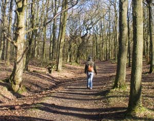
From the car park, walk between the barn and the information centre. Cross the road and pass through the wooden kissing gate to enter woodland. Pass through a metal stile, cross a wide track. The narrow path ahead leads you through the Rivington Pinetum. The path emerges onto another wider track: turn right on to this, pass through a gate and turn immediately left. This track climbs and passes through two metal gates - with kissing gates at the side of each. You then come to point where three paths join from the left - we followed the upper one of these - but from this point, the grounds become quite a maze of paths. It really doesn't matter in which direction you go - as long as you keep going up, to emerge on the moors near the pigeon tower. | |
|
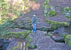
This narrower path provided breathing space before the next climb!. We crossed a stream by walking on concrete blocks - as shown in the photograph. We could see other paths below and above, each crossing the same stream by bridge. Shortly after crossing the stream, we passed a shelter on our right and then turned right to climb steps. At the top of the steps we turned left, then where the path divided, followed the left hand fork. Where this path joined a wider track, we turned left. At an open area, where there was a finger post at the junction of paths, we turned right. | |
|
|
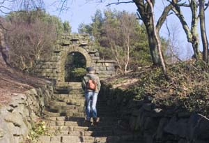
We turned left, up steps under an arch (shown left), crossed a path and continued up more steps. At the top we turned left, following the path to a gateway. We turned left on to a wide track (the more energetic might like to turn right, and continue to the tower at the summit of Rivington Pike). | |
|
|
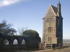
Walk past the pigeon tower, taking the lower, left hand path. Follow this track down to the car park. Turn right through the car park to leave by a wooden kissing gate. |
|
Cross an area of open land, keeping a derelict boundary wall to your right. There are places where marshy ground is crossed by a boardwalk and a bridge. Cross a stile into a narrow strip of woodland, then another stile to leave it. After crossing another open area, climb a stile then walk down to cross a stream. At the other side of the stream, follow the path up to another stile and the road. Turn left and follow the road for about 500 metres. |
|
|
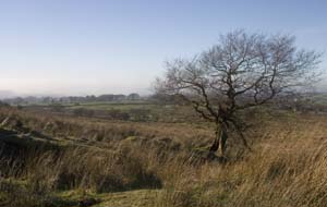
Follow the footpath sign on the right, which leads into the field pictured. Walk towards the stile - but do not cross it.
Turn left and follow the boundary wall. Cross two ladder stiles, a normal wooden stile, followed by another ladder stile.
In this small field (inhabited by goats when we walked through) keep right and leave by yet another ladder stile to emerge on a narrow road.
Turn left, pass the entrance to Wilcock's Farm Caravan Site, then turn right, to follow a footpath that runs alongside Dean Wood Nature Reserve.
The path emerges on a driveway. Follow this round, until you reach Upper Rivington Reservoir. Continue to the road.
Turn left, then follow the first footpath on your right. Where the path divides, take the right hand fork. This continues close to the
Lower Reservoir, before turning to the left, close to the Great House Barn Car Park where we started.
|
Back to:
Walks Index
Graham & Lin Dean's Home Page