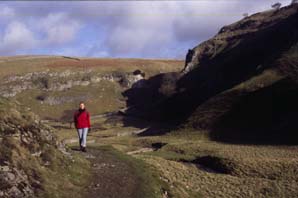
Based on a walk from OS/AA Leisure Guide: Yorkshire Dales.
Map: Sheet 2 Yorkshire Dales - South and West .
Start: Burnsall village car park (grid ref. SE032612)
From the village car park, cross the bridge and then turn into the field on the right (in summer this field is used as a car park). Walk up a slight incline, and follow the path down to the river. This section of the route follows the Dales Way. The path continues in the same direction, through Woodhouse Farm, whilst the river turns to the south. The river and path rejoin - continue along the path until there is a touring caravan/camping site on the left. Turn left to follow the signposted path along the far side of the camp site to join the road. Turn right along the road towards Appletreewick. One of the first buildings in the village is the Craven Arms - The leek and potato soup and the open fires were equally warming on the cold January day we visited!

From the pub, continue along the road through the village. Carry straight on at the road junction which is about 1/4 mile beyond the church. At the next road junction take the right fork (no through road sign). Continue through the hamlet of Skyreholme, to a road junction in Middle Skyreholme.
Take the left fork (signposted Parcevall Hall). The road bends to the right. Do not cross over Fir Beck - but cross the stile on the left, immediately before the bridge.Follow this path for about 1/4 mile. At a junction of paths - take the right fork. (This path is not shown on my 1997 edition of the map - but was clearly signed as a concessionary route when we completed this walk in January 2001). You pass close by two springs, then follow the dry river bed through Troller's Gill. The Gill is a narrow, eerie valley - take care walking over the limestone boulders. The valley opens out, and the stream is met again - despite the dramatic valley, there are no large potholes - the stream just sinks through small, loose rocks in the stream bed. The path is easier to follow on the right of the beck.
A sign points out a concessionary route to the left - cross the beck with care! The route is marked by wooden posts, up a hill, to join the track which is the public right of way. Follow the waymarked path to left, which is again marked by wooden posts. On reaching the road, turn left and walk to a left hand bend.
The OS map shows a public right of way following the direction of the road - there is a gate - but no sign of a path. Walk about 100 yards past the bend in the road. Turn right on to the clear track. This track continues in the same direction for just less than a mile, then turns slightly to the right. At a junction of paths keep straight ahead. The track drops down to provide a view of Hartlington Hall, then bends to the left. Go straight across the road, following the path to Woodhouse Farm. On meeting the Dales Way, turn right to re-trace your steps to Burnsall.
Back to:
Walks Index
Graham Dean's Home Page