|
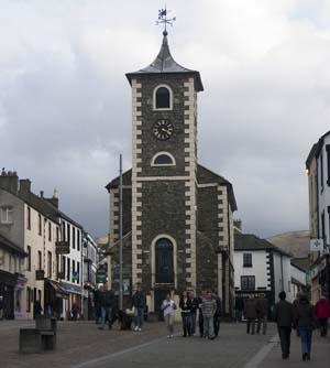
From the Market Place walk along Saint John Street, passing the cinema and church on your right. Take first right along Springs Road. At the end of the houses you come to Springs Farm on the right. The road becomes a footpath. Follow the footpath sign ahead and go through small wooden gate.Continue along broad track as it climbs through woods with stream on left. Turn right before footbridge, following sign for Rakefoot Farm, Walla Crag and Castlerigg Stone Circle. Walk past mobile 'phone mast, ignore footpath signed for Borrowdale on right and continue ahead with stream on left. Go through a kissing gate, cross stream and climb steps. Proceed through gate to emerge on narrow road. Turn right. |
|
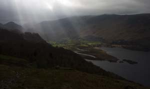
Cross footbridge and follow the track along the left of the stone wall. The stony path leads through small wooden gate (to left of larger gate). Where path divides, continue to follow the wall. The path eventually levels, then drops slightly, before climbing again. Pass two cairns, and continue along wall. The path dips down to a boggy area, then climbs again. Climb stile on right to spectacular views over lake. Re-cross the wall further along - down short, rocky slope close to small cairn. The path divides - take the left fork, away from the wall. To start off with, the path is marked with cairns at regular intervals. The path descends fairly gradually, with good views of the Derwentwater on the right. The path continues in the same direction until very close to the minor road. Cross stream, then turn right to meet road. |
|
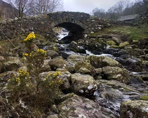
Turn right along road, crossing the much-photographed Ashness Bridge.At the junction with Keswick/Borrowdale Road , cross the road to the stile which leads down to the lake side. (To avoid the scrambles, you can walk along the road for about one mile, and re-join the path at the Ings.) Turn right along the shore. This narrow stretch of lake shore is probably the most difficult part of the walk, involving short scrambles up and down, where there isn't room to walk along the shingle shore! The path rounds Calfclose Bay, then turns inland opposite Lord's Island. At a junction of paths turn left (this is where you will re-join the route if you have walked along the road). Follow path through woodland, cross bridge and re-join lake shore at Strandshag Bay. |
|
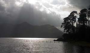
At the far end of the bay, follow path into woodland, and turn first left. This leads to another much photographed spot - the viewpoint at the end of Friar's Crag. From here, follow the path close to the lake shore, which passes the Keswick landing stage, and becomes Lake Road. Pass the theatre on your right, then under the subway to return to the town centre. |
Back to:
Walks Index
Graham & Lin Dean's Home Page