| Map: | Sheet OL41 Forest of Bowland and Ribblesdale |
| Start: | Slaidburn Car Park. (SD714524) |
| Route: | Much of the route is along public footpaths which are little used, across fields and not clear on the ground. There is a short section of road walking, and some farm tracks. |
| More info. | Slaidburn.org.uk. |
| Refreshments | Riverbank tearooms & the Hark to Bounty inn. |
|
|
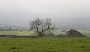
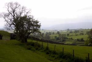
From the car park, turn left and cross the bridge over the River Hodder. There are two footpath signs on the left immediatly after the bridge. Folloow the second of these signs, walking through the car park/yard of Poorsland Barn. Go through the gate at the far end of the yard and follow the path which leads slightlt to the left. There is a white topped marker post to help find the path (it's not very clear on the ground). A stile leads over a wire fence. Follwo the field boundary on left and cross stile. Continue with field boundary now on right. Near the end of thsi field, cut across the corner to a stile in what little remains of a stone wall. In next field keep close to the boundary on your right. Go through wooden gate and head for ladder stile opposite. Cross ladder stile and continue walking in same direction. Leave this field by a ladder stile in the eastern corner. A short path leads down to a track. Cross the track to discover a weel-hidden footbridge across a stream. | |
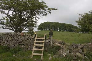
From the footbridge walk up to stile over fence and walk by the side of a stone wall. Just before the corner of the field cross the stile on right. Walk across to wooden stile over wire fence. Continue in the same direction until you reach the wire fence. Walk next to this in the direction of the group of trees (Pikefield Plantation. Cross the next stile and walk to the left of the plantation. Go through kissing gate and along path between hawthorn bushes. Go through a wooden kissing gate on the right. Follow the filed boundary to start with, then bear right towards farm buildings. Go through metal gate and follow track through farmyard, round to the right and then up to the road. |
|
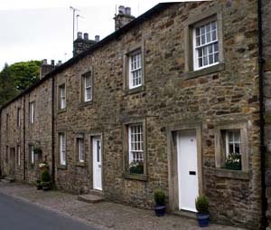
Turn left along the road. Immediatly after rather impressive house on left go through gate on left. Walk down the hill and between trees (where there looks as though there was once a field boundary). Cross the stream by a wooden plank and cross stone wall ahead by means of stone stile. Continue in a similar direction until you reach Brook House Green. |
|
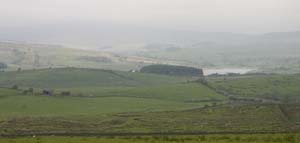
From here navigation becomes simpler - turn left and follow the track. At Rain Gill the track passes through two metal gates. Ignore a third gate and walk up grassy bank. Cross two field boundaries and then bear right down to footbridge. Cross the bridge and bear left up slope. Pass through wooden gate, and follow the field boundary on your left. Go through metal gate and follow clear farm track. At junction of tracks keep the farm building on your right, taking the left fork in tracks to pass through a wooden gate. Cross bridge and follow track round to right. Bear right and cross the Hodder by Holmehead Bridge. Cross cattle grid and take the footpath on left before stone wall. Cross ladder stile and go through gate. Before river turn right to follow boundary towards kissing gate. Go through gate and turn left on to road. At road junction by war memorial turn left to return to car park and tea shop (turn right for pub). |
|
|
Other walks near here:
Back to:
Walks Index
Graham & Lin Dean's Home Page